Provincial Climate Narratives
Climate Description
The section below provides a description of the climate as well as recent trends in climate for each of the nine provinces. Select a province from the list below to see the narrative.
- All
- Gallery Filter

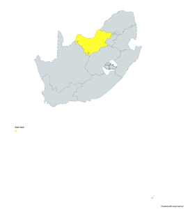
Gauteng is characterized by a summer rainfall region where precipitation primarily occurs as thunderstorms, reaching 700mm annually. Winters are dry with clear skies, leading to cold nights and strong inversion layers that cause polluted mornings. The province’s water relies not only on local dams and rainfall but also significantly (40%) on water supplied from the mega-dam region of southeastern South Africa.
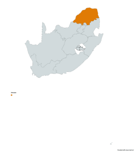
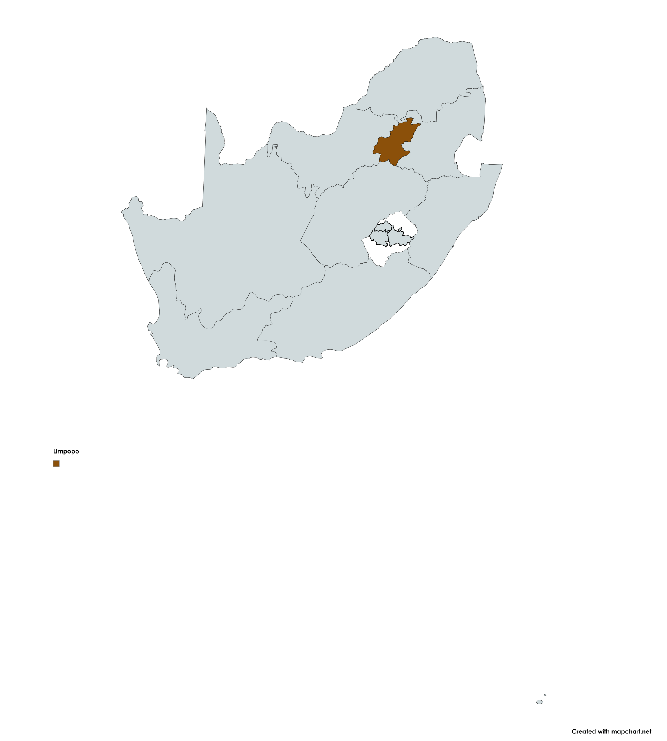
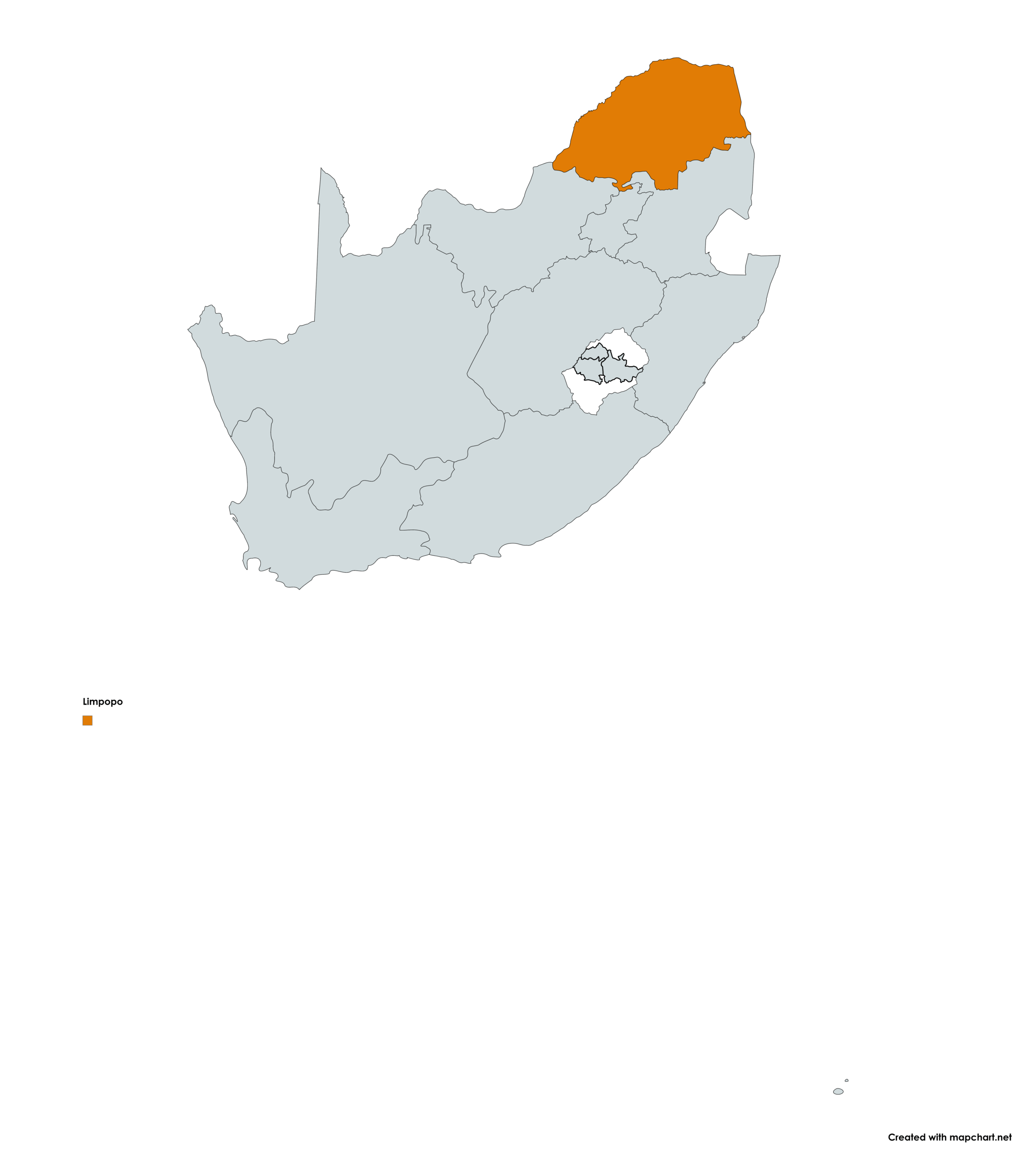
Limpopo is a summer rainfall region that generally experiences hot summers and cooler winters. Rainfall varies greatly across the province, with large parts of the Limpopo basin being semi-arid, and with high rainfall and rainforests along the eastern escarpment of the province. The province sporadically suffer from devastating flood events, when tropical lows or cyclones from the Indian Ocean make landfall over neighbouring Mozambique, or even over Limpopo itself.
Mpumalanga’s Lowveld region experiences a sub-tropical climate, with high rainfall totals towards the escarpment in the west and with a drier climate to the east. The Mpumalanga Highveld experiences cold winters with frost events, with summers being warm and with rainfall occurring mostly in the form of thunderstorms.
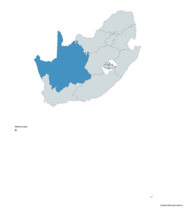
The climate in the North West province varies considerably with the areas in the east being much wetter than those in the west, Average annual rainfall ranges from 300 to 700 mm and summer temperatures between 22 and 34ºC. The province is dominated by a flat savanna and grassland landscape, which is home to rich biodiversity and agriculture, with hills and ridges dividing up this landscape.
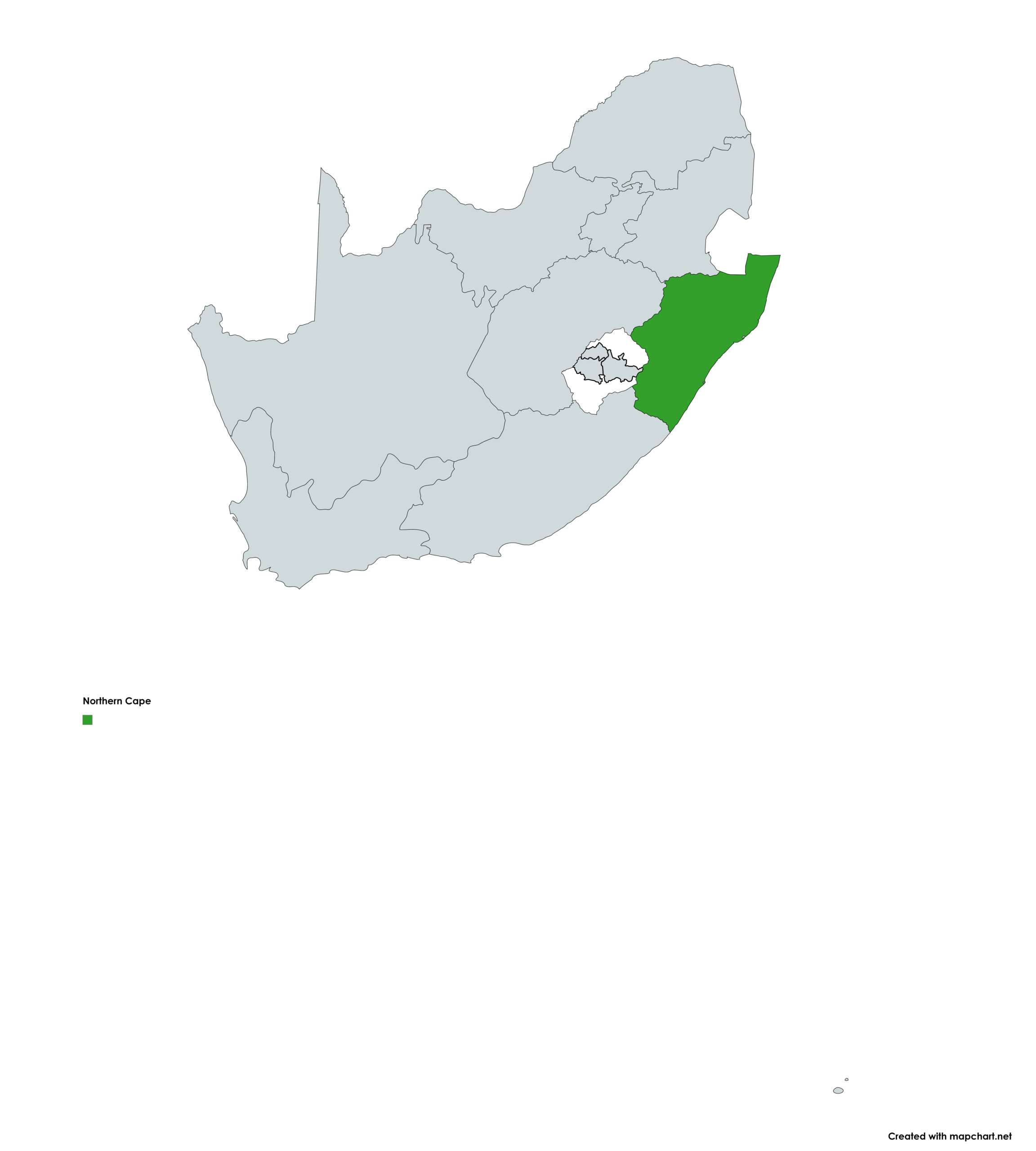
The Northern Cape is South Africa’s driest province (some areas <70mm/yr), defined by extreme aridity. Rainfall is highly infrequent and spatially varied: the south-west receives winter rain, while the rest receives summer convection. The region experiences extreme temperature swings: summer daytime highs can exceed 36°C while winter nights often drop below 0°C. The extremely dry western coastline is a coastal desert where marine fog is a vital water source.

The Free State spans the country’s center, exhibiting a climate gradient from the dry, hot west (450 mm/yr) to the cooler, wetter north and east (1200 mm/yr). It’s entirely a summer rainfall region, dominated by convective events (thunderstorms). Rainfall is partially linked to ENSO. The province is the nation’s “bread basket,” sustaining extensive rain-fed maize and wheat production due to sufficient rainfall and good soils.
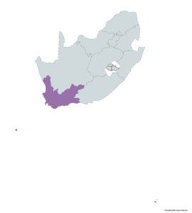
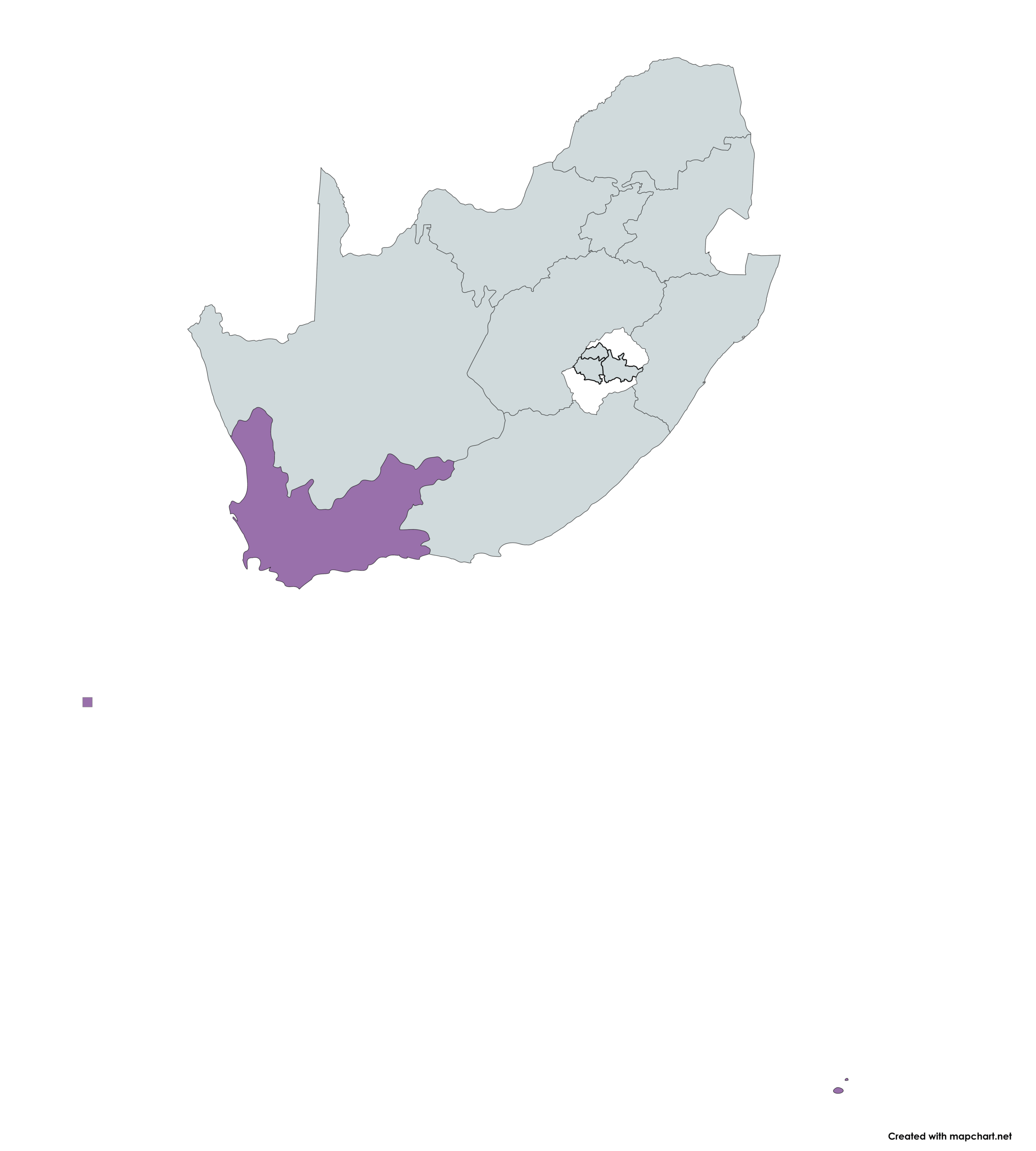
The Western Cape has a highly diverse climate. Rain is dominated by mid-latitude cold fronts (mainly winter), creating a rain shadow inland, where summer convection occurs. Marine fog/cloud capture and strong systems cause significant water input and flooding. The province faces natural drought cycles, but no long-term rainfall trend is currently clear.
Climate Futures
The section below provides a description of the climate futures for each of the nine provinces. Select a province from the list below to see the narrative.
- All
- Gallery Filter

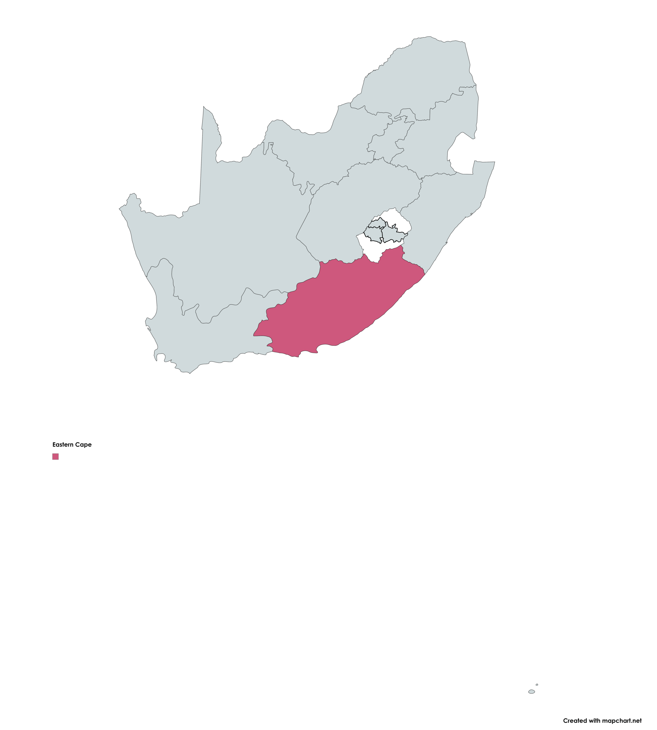
The Eastern Cape will experience warmer temperatures, rising 1.5°C by 2040-2060, maintaining wet/dry cycles.
Warmer Future (Intense Rain)
Warming leads to more intense rain inland (due to stronger heat low) and coastal flooding/heavy rain (due to warmer Agulhas Current). Storm surge compounded by sea-level rise threatens coastal infrastructure.
Warmer Drier Future (Water Stress)
Warming increases summer hot spells and evaporation, resulting in drier soils and higher irrigation demand. Increased dam evaporation and competing needs from agriculture/urban growth will significantly strain urban water supply.
Gauteng, under low mitigation, faces a 3-4 °C temperature rise by 2040-2060, drastically increasing heat-wave days and fire danger, while reducing frost. Local intense thunderstorms (hail, floods) are plausible.
Scenario 1: Warmer & Water-Stressed
Rising temperatures coupled with drought in the mega-dam region will severely impact water security, constraining future economic growth.
Scenario 2: Warmer but Water Secure
Temperatures rise, but the mega-dam water yield is sustained or enhanced by intense escarpment thunderstorms. Gauteng manages heat and local extreme rain, but its water supply remains relatively secure.

KwaZulu-Natal faces two main future climate scenarios by 2040-2060.
Scenario 1: A Hot and Dry Future
Under low mitigation, temperatures could increase by up to 3°C, accompanied by a drastic decrease in rainfall. This will lead to more frequent heat-wave days, high fire-danger days, and El Niño-induced droughts. Key impacts include significantly reduced yields in the forestry and sugar cane industries, and increased risks to human health from oppressive temperatures.
Scenario 2: A Hot Future with Increased Rainfall
The main alternative is a hotter future with substantially increased rainfall, including more intense thunderstorms and damaging floods. This scenario offers more options for the sugar cane and forestry sectors but will cause frequent damage to infrastructure (roads, bridges). The increasingly hot and humid climate may also lead to a greater abundance of pests and diseases affecting crops, forestry, and human/animal health.
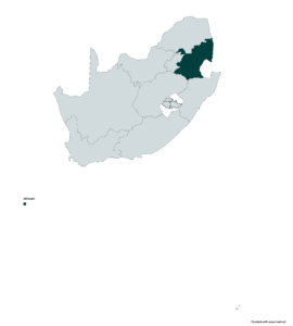
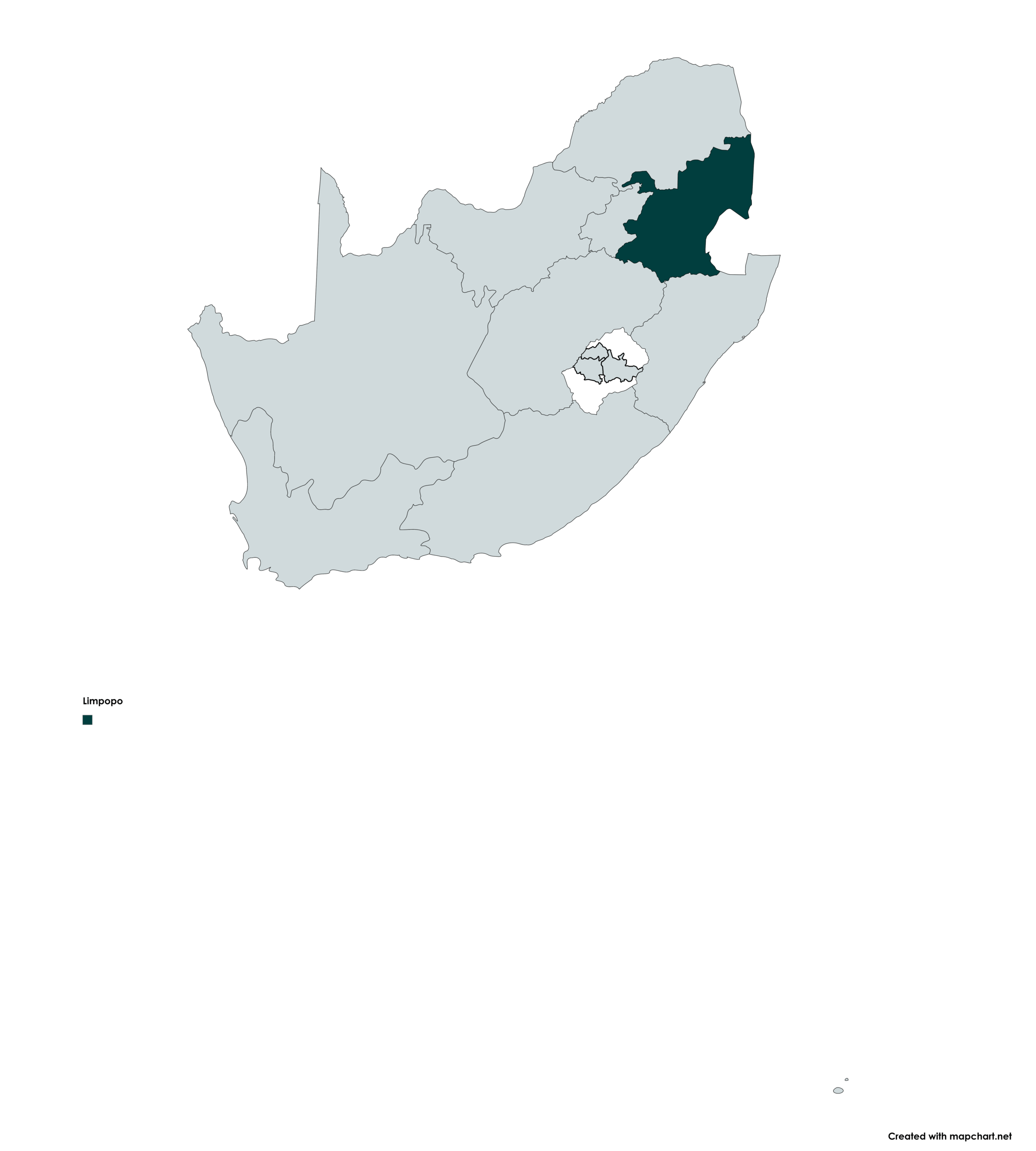
Limpopo faces significant warming, with temperature increases of 4°C plausible by 2040-2060 (up to 7°C by the end of the century under low mitigation). This will increase heat-wave days and high fire-danger days.
Scenario 1: Hot and Dry (Drought & Agricultural Stress)
The province becomes drier overall, with more frequent El Niño-induced droughts. Under this scenario, dryland agriculture and livestock production will become increasingly unviable.
Scenario 2: Warmer with More Floods (Tropical Lows)
A minority of models project a wetter future, especially in the Limpopo basin and along the escarpment, due to more frequent and intense tropical lows and cyclones. The province would still face the negative impacts of rising temperatures (as in Scenario 1) but with increased flood events.
Mpumalanga faces two main climate futures by 2040-2060, with temperatures possibly rising by up to 3°C under low mitigation.
Scenario 1: Hot and Dry (Drought & Fire Risk)
The province becomes significantly hotter and drier, drastically decreasing rainfall and increasing heat-wave days and high fire-danger days. This poses a significant threat to the forestry sector due to more frequent drought-induced forest fires.
Scenario 2: Warmer with Increased Rainfall (Floods & Pests)
Rainfall totals increase, potentially due to more frequent landfalling tropical lows over the Lowveld. This scenario alleviates drought for forestry but poses significant risks to tourism and infrastructure (e.g., Kruger Park). Increased rainfall and warmth may also lead to new challenges from proliferating pests and pathogens affecting forestry and agriculture.
The North West province faces a significantly warmer future.
Scenario 1: Hot and Dry (Low Mitigation)
Under low mitigation, temperatures could increase by up to 6°C, accompanied by a drastic decrease in rainfall. This will result in more frequent heat-wave days and high fire-danger days.
Scenario 2: Warmer with Wet Spells (High Mitigation)
Under high mitigation, temperatures may still increase by up to 4°C. However, this scenario includes more frequent formation of tropical-temperate troughs, leading to increased wet spells over the province.
The Northern Cape will warm faster than the rest of the country, especially in the north/east, reaching 2°C warmer by 2040-2060. This dramatically increases summer hot spells (20-30 days >36°C per month in the north).
Scenario 1: Hotter and Drier (Water Stress)
A southerly shift in the mid-latitude jet stream reduces winter frontal rain in the south-west. Increased high-pressure systems suppress summer convective rain in the east. Reduced rainfall combined with high temperatures and evaporation places a severe strain on dams and groundwater recharge, impacting irrigation and human consumption.
Scenario 2: Hotter, Mixed Rainfall (Intense Summer Rain)
In the east, an intensified heat low and increased moisture transport lead to increased summer rainfall. These dynamics also produce more intense rainfall events, causing localized flooding and infrastructure damage.
The Free State faces warming of 2°C by 2040-2060, increasing hot spells and crop stress. Higher temperatures/evaporation and generally reduced rainfall will cause water deficits worse than the 2015/16 drought.
Scenario 1: Warmer & Drier
High pressure suppresses moisture and convection, reducing rainfall frequency/magnitude. Remaining storms are more intense, causing localized flooding.
Scenario 2: Warmer & Wetter (East Only)
An intensified heat low slightly increases rain in the east but leaves the west unchanged/drier. All convective events are more intense, leading to localized flooding and damage.
The Western Cape faces warming of 1.5°C 2040-2060 (rising 0.5°C decade), increasing hot spells and reducing cold spells. Stronger high-pressure systems intensify summer South-Easter winds. Higher temps/winds increase evaporation, straining urban and agricultural water supply systems.
Scenario 1: Drier, Hotter, Windier
Natural cycles shift toward more frequent and consecutive dry years. Rising temperatures and wind speeds enhance evaporation, critically stressing water resources and increasing competition. Winter storm intensity increases, causing frequent flooding and damage.
Scenario 2: Warmer & Wetter
Rainfall increases in the mountains (due to moist winter storms and summer southerly flow), increasing river flows and dam runoff. However, this gain is offset by higher evaporation (from 2°C warming/stronger winds) and rising urban demand, meaning adaptation is still required.
Legal
Support
- Department of Forestry, Fisheries, and the Environment, Climate Change Monitoring and Evaluation, 473 Steve Biko, Arcadia, Pretoria, 0083
- NCCRD@dffe.gov.za
- 086 111 2458